Snowdon, or Yr Wyddfa, is the highest mountain in Wales at 1,085 metres, and there is no single way to the top. Six main paths up Snowdon lead to the same summit cairn and the Hafod Eryri visitor centre, and each one has a different character, length and level of difficulty. Choosing the right route matters more than most first-timers expect: the gentlest path is nearly three times longer than the shortest, and the hardest standard route climbs more than a kilometre from valley to summit. This guide compares all six Snowdon routes side by side, explains who each one suits, and covers the knife-edge Crib Goch scramble that sits in a category of its own.
Every one of these routes is graded Hard or Strenuous by the Eryri National Park Authority, the highest category for mountain walking. None of them is a stroll. Whatever you choose, you need walking boots, waterproofs, warm layers, food, water and a map or GPS, because the weather on Yr Wyddfa can turn from summer to winter in an afternoon.
The six main paths up Snowdon at a glance
This table compares the starting point, distance, total ascent, typical time and difficulty of each of the six main routes. Times are return estimates for a reasonably fit adult in good summer conditions.
| Route | Start (elevation) | Distance | Ascent | Time | Difficulty |
|---|---|---|---|---|---|
| Llanberis Path | Llanberis (100 m) | 14.5 km / 9 mi | 975 m | 6–7 hrs | Easiest |
| Pyg Track | Pen y Pass (359 m) | 11 km / 7 mi | 723 m | 5–6 hrs | Hard |
| Miners’ Track | Pen y Pass (359 m) | 13 km / 8 mi | 723 m | 5–6 hrs | Hard |
| Snowdon Ranger Path | Llyn Cwellyn (180 m) | 13 km / 8 mi | 936 m | 5–6.5 hrs | Moderate |
| Rhyd Ddu Path | Rhyd Ddu (190 m) | 12 km / 7.5 mi | 890 m | 6–7 hrs | Hard |
| Watkin Path | Pont Bethania (60 m) | 13 km / 8 mi | 1,015 m | 6–7 hrs | Hardest |
Llanberis Path: the easiest route up Snowdon
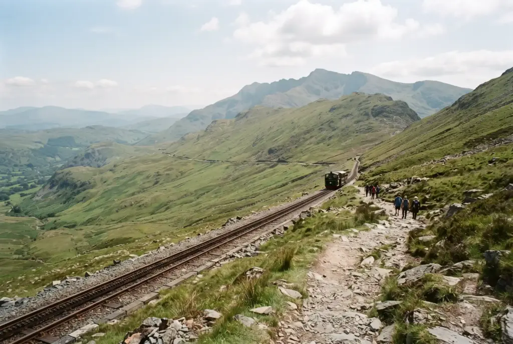
The Llanberis Path is the longest route at 14.5 km return, but it is also the most forgiving. It climbs steadily beside the Snowdon Mountain Railway with only a couple of steeper pulls, which is why it is the usual recommendation for the easiest route up Snowdon and the best choice for a first ascent. The path is wide and clear, and the Halfway House cafe offers a rest and refreshments on the way up. The trade-off is that it is the busiest route and, because it never feels dramatic, some walkers find it a long slog rather than a thrill. Start from Llanberis village; the small car park at the trailhead fills early, so use the village car parks and walk up.
Pyg Track: the shortest and most direct
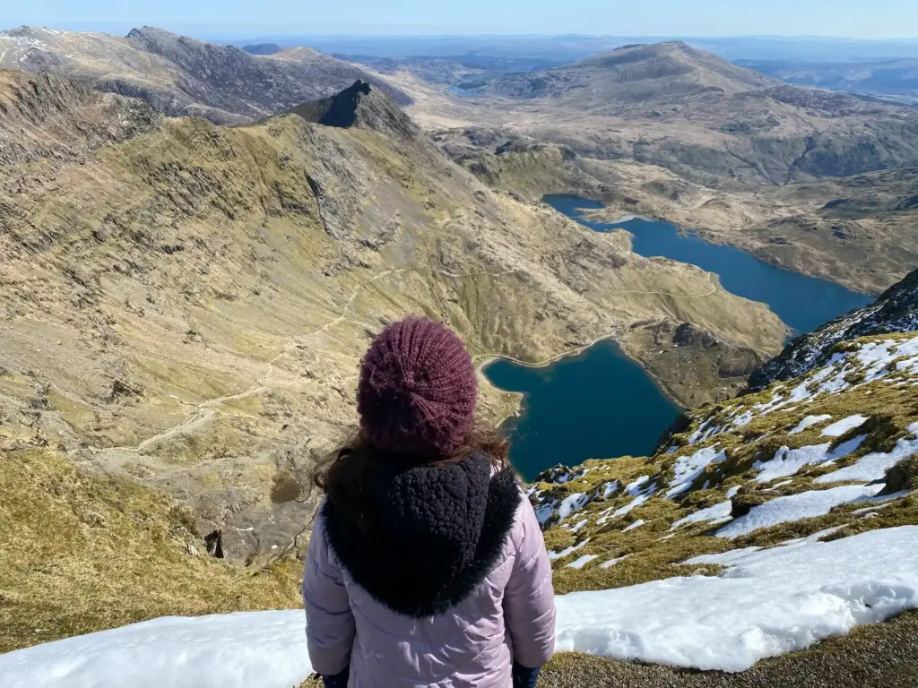
Starting high at Pen y Pass (359 m), the Pyg Track is the shortest route to the summit at around 11 km return, and one of the most scenic from the very start. It climbs to Bwlch y Moch with early views of the Crib Goch ridge and the Snowdon Horseshoe, then traverses above Glaslyn before a rocky final zig-zag to the summit ridge. It is rough and rocky underfoot and demands sure footing, so despite being short it is graded Hard. Because it shares the Pen y Pass trailhead with the Miners’ Track, many walkers go up the Pyg and down the Miners’ for a natural circular walk.
Miners’ Track: the route for the lakes
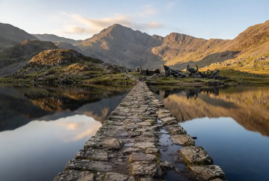
Also starting at Pen y Pass, the Miners’ Track begins almost flat on a wide mining road past Llyn Teyrn and across the causeway at Llyn Llydaw, reaching the turquoise waters of Glaslyn. This gentle lower section makes it popular with families who want a lake walk without summiting. Beyond Glaslyn, though, it climbs steeply on rough ground to join the Pyg Track below the summit, so the full route to the top is firmly in Hard territory. The scenery around the lakes is some of the finest low-level walking in Eryri.
Snowdon Ranger Path: the quiet, moderate choice
The Snowdon Ranger Path is the oldest named route up the mountain and, graded Moderate, arguably the most straightforward underfoot. It climbs from Llyn Cwellyn in steady zig-zags with no scrambling and no exposed ridges, and it is much quieter than the Llanberis Path. It is also one of the two routes reachable by public transport, with the Welsh Highland Railway stopping nearby. If you want a less-travelled path without a head-for-heights section, this is the pick.
Rhyd Ddu Path: the route to avoid the crowds
For solitude, the Rhyd Ddu Path sees far fewer walkers than any of the eastern routes. It climbs gradually from Rhyd Ddu village before a more dramatic finish along Bwlch Main, a narrow and exposed ridge that calls for a steady head for heights and confident navigation in poor visibility. It is also served by the Welsh Highland Railway, which makes a Rhyd Ddu up, Snowdon Ranger down (or vice versa) traverse possible without two cars.
Watkin Path: the hardest standard route
Starting from the lowest trailhead at Pont Bethania (60 m), the Watkin Path has the greatest total ascent of any route at over 1,000 metres, which is what earns it the “hardest” label among the walking paths. It is also the most varied: oak woodland and waterfalls low down, the historic Gladstone Rock and old copper-mine and WWII commando ruins, then a tough, loose scree slope near the top where the path is hard to follow. The final section onto the summit ridge is steep and demanding, so the Watkin Path suits experienced hill walkers rather than first-timers.
Crib Goch: a scramble, not a path
You will see Crib Goch listed alongside the paths, but it is not a walking route. It is an exposed Grade 1 scramble along a knife-edge ridge with long drops on both sides, and it is by far the most serious and dangerous way onto Snowdon. It should only be attempted by experienced scramblers with a head for heights, in good weather, and never as a first route up the mountain. People are seriously injured or killed on Crib Goch most years. If you are comparing paths up Snowdon as a walker, treat Crib Goch as out of scope.

Which route up Snowdon should you choose?
With six genuine options, the right path depends on what you want from the day:
- First time up Snowdon: the Llanberis Path, for its steady gradient, clear path and facilities.
- Shortest route: the Pyg Track, starting high at Pen y Pass.
- Best for the lakes and families: the Miners’ Track to Glaslyn (summit optional).
- Quietest without an exposed ridge: the Snowdon Ranger Path.
- Most dramatic scenery: the Pyg Track, for Crib Goch and Glaslyn views from early on.
- Arriving without a car: the Snowdon Ranger or Rhyd Ddu paths, both on the Welsh Highland Railway.
- History and the biggest challenge: the Watkin Path.
A popular combination is the Pyg Track up and the Miners’ Track down, which gives you the dramatic high traverse on the way up and the lakes on the way back, all from the same Pen y Pass car park.
Planning your Snowdon walk: parking, transport and safety
Parking at Pen y Pass must be booked in advance. The small, popular car park for the Pyg and Miners’ tracks is pre-book only and sells out, so reserve a slot or use the Park and Ride at Nant Peris with the Sherpa’r Wyddfa bus. The Sherpa bus network links all the main trailheads, which is what makes point-to-point routes practical. Llanberis has larger village car parks for the Llanberis Path.
If you do not want to walk, the Snowdon Mountain Railway runs from Llanberis to the summit station beside Hafod Eryri, weather permitting. It is a popular alternative for families and anyone not equipped for a mountain day.
The best time to walk Snowdon is late spring to early autumn, when the paths are clear of snow and the days are long. In winter the upper mountain holds snow and ice and becomes a serious mountaineering objective needing an ice axe, crampons and the skills to use them. Whatever the season, check the mountain forecast, start early, carry warm and waterproof layers, and be ready to turn back if cloud, wind or your pace makes the summit unwise.
Frequently asked questions
What is the easiest route up Snowdon?
The Llanberis Path is the easiest route up Snowdon. At 14.5 km return it is the longest, but it climbs steadily beside the mountain railway with only a few steeper sections and a clear, wide path, which makes it the usual choice for first-timers.
What is the shortest route up Snowdon?
The Pyg Track is the shortest at about 11 km return. It starts high at Pen y Pass (359 m), so there is less climbing overall, but it is rough and rocky and still graded Hard.
What is the hardest path up Snowdon?
Among the walking routes, the Watkin Path is the hardest, with the greatest ascent (over 1,000 m) and loose scree near the top. Crib Goch is harder still, but it is an exposed Grade 1 scramble rather than a path and should only be attempted by experienced scramblers.
How long does it take to climb Snowdon?
Most routes take a reasonably fit adult 5 to 7 hours return. The Pyg, Miners’ and Snowdon Ranger paths are usually quicker (5–6 hours); the Llanberis, Rhyd Ddu and Watkin paths take longer (6–7 hours). Allow extra time for poor weather, a heavy pack or less experience.
Do I need to book parking at Pen y Pass?
Yes. The Pen y Pass car park, which serves the Pyg Track and Miners’ Track, is pre-book only and sells out quickly. Reserve a slot in advance, or use the Nant Peris Park and Ride with the Sherpa’r Wyddfa bus to the trailhead.
Can you get a train to the top of Snowdon?
Yes. The Snowdon Mountain Railway runs from Llanberis to the summit station next to the Hafod Eryri visitor centre, subject to weather. It is a good option if you do not want to walk, though services and how far they run vary with conditions.