Introduction
Most “secret places” lists are anything but. The same forty locations circulate every year, get geotagged into oblivion, and arrive at your feed already ruined by the crowds the article claims to help you avoid. Social media has flattened travel into a queue for the same photograph. The places below resist that machine, not because a writer decided they were undiscovered, but because real barriers keep the numbers down: no international airport, a permit you cannot buy online, a road that floods for half the year, a border that scares operators off, a tide that will drown the trail if you mistime it. This guide skips the adjectives and gives you the logistics that actually determine whether you can go, when, and how much of the paperwork is on you.
Table of Contents
The 10 destinations at a glance
| Destination | Region | Isolation tier | Main access barrier | Peak season |
|---|---|---|---|---|
| Socotra Island | Yemen, Arabian Sea | Extreme | Tour-only; seasonal charter flights | Oct–Apr |
| Ittoqqortoormiit | East Greenland | Expedition-grade | Iceland flight + heli/boat; sea ice | Jul–Sep |
| Danakil Depression | Afar, Ethiopia | Expedition-grade | Armed-escort tour; extreme heat | Nov–Feb |
| Tuvalu | South Pacific | Extreme | Single air route via Fiji | May–Oct |
| Tsingy de Bemaraha | Western Madagascar | Extreme | Dry-season 4×4 + two river ferries | Jun–Nov |
| Gangkhar Puensum base | Northern Bhutan | Expedition-grade | Licensed operator + SDF; restricted trek | Apr–May, Oct–Nov |
| The Lost Coast | California, USA | Moderate | BLM permit + tidal timing | May–Sep |
| Ushguli, Svaneti | Caucasus, Georgia | Moderate | Unpaved 4×4 road; winter closure | Jun–Sep |
| Con Dao Archipelago | Southern Vietnam | Moderate | Flight/ferry + national-park permits | Sep–Nov |
| Eduardo Avaroa Reserve | Southwest Bolivia | Extreme | High altitude + multi-day 4×4 | May–Oct |
What defines a truly untouched destination?
“Untouched” is overused, so it is worth being concrete. A place earns the label here by meeting most of these tests:
- No mass air or cruise pipeline. There is no wide-body airport and no daily cruise berth funnelling thousands of people in. Access is a small propeller plane, a charter, a multi-day drive, or a boat that runs a few times a week.
- You cannot go alone. A licensed local operator, a permit, or an armed escort is legally required, which caps the numbers and channels money to the community rather than to an international chain.
- Sovereign or conservation control. Entry is gated by a government permit, a national-park quota, or a protected-area licence, not just by a hotel booking.
- Leave-no-trace is a necessity, not a slogan. There is no waste collection, no rescue service on call, and no shop to resupply, so you pack in and pack out, carry your own water and comms, and assume self-extraction.
Meet three of those four and a place stays genuinely quiet, because the friction itself is the filter.
The 10 most remote, untouched destinations on Earth
1. Socotra Island, Yemen
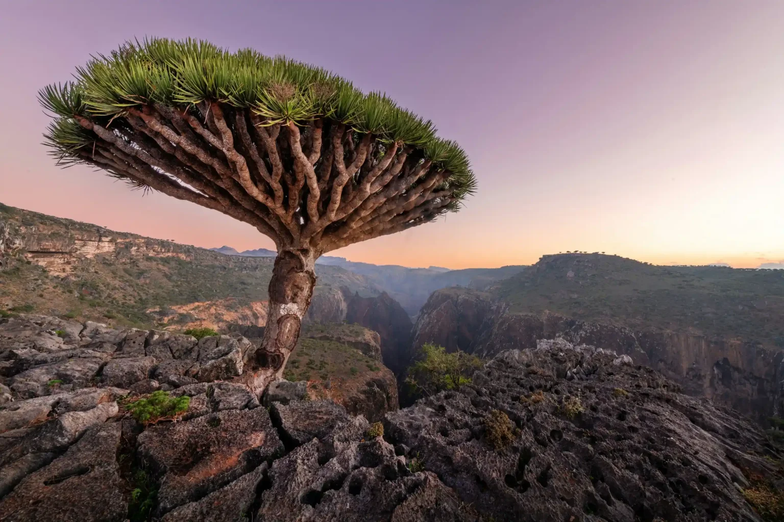
The terrain and appeal. An island in the Arabian Sea that split from the mainland millions of years ago and evolved its own biology. Roughly a third of its plants grow nowhere else, led by the umbrella-shaped dragon blood tree of the Diksam Plateau. Add white dunes running into a turquoise sea at Arher and the glowing lagoon at Detwah, and it looks engineered for another planet.
Why it remains untouched. It belongs to Yemen, a country under active conflict and blanket travel warnings, which scares off casual visitors even though Socotra itself sits far offshore and has stayed peaceful. There is no independent travel and no simple flight, so numbers stay in the low thousands a year.
Field logistics and access.
- Route: everyone travels with an authorised operator who books the flight. Routes shift by season; the 2026 mainstay is a weekly Yemenia flight from Jeddah, Saudi Arabia, while charter flights from Abu Dhabi have run in past years and may return.
- Permits: an entry permit, usually around USD 150, is arranged for you by the operator. A passport valid six months is required.
- Season: October to April. The June-to-September monsoon suspends most flights and closes the island.
- Lodging: camping beside the dunes and forests, with basic guesthouses in the town of Hadibo. Cash only, in US dollars.
2. Ittoqqortoormiit, Greenland
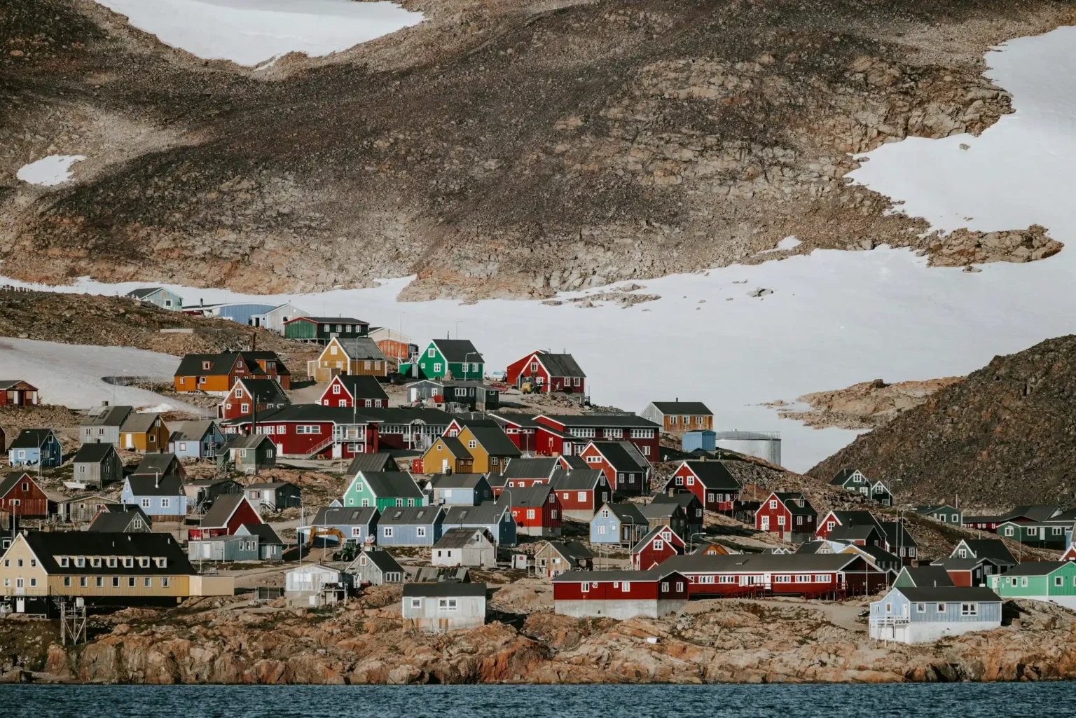
The terrain and appeal. One of the most isolated inhabited places on Earth, a town of a few hundred people on the edge of Scoresby Sund, the largest fjord system on the planet, which reaches some 350 km inland. Icebergs, musk oxen, polar bears, dog sleds and, in the dark months, the aurora.
Why it remains untouched. There is no road to anywhere, and the sea freezes for much of the year. The town is reachable only by a small Icelandic airline and a helicopter hop, or by ship during the short ice-free window, which naturally limits arrivals to a trickle.
Field logistics and access.
- Route: fly from Reykjavik or Akureyri in Iceland to Nerlerit Inaat (Constable Point) on Norlandair, roughly twice a week, then cover the last ~40 km by Air Greenland helicopter (about 10 minutes), or by boat in summer and snowmobile in winter.
- Alternative: a small number of expedition cruises call in during summer.
- Season: July to early September, when Scoresby Sund is generally free of ice and the town is reachable by boat.
- Lodging: a guesthouse and a handful of homestays; book everything, including the onward transfer, well ahead, as seats and beds are scarce.
3. The Danakil Depression, Ethiopia
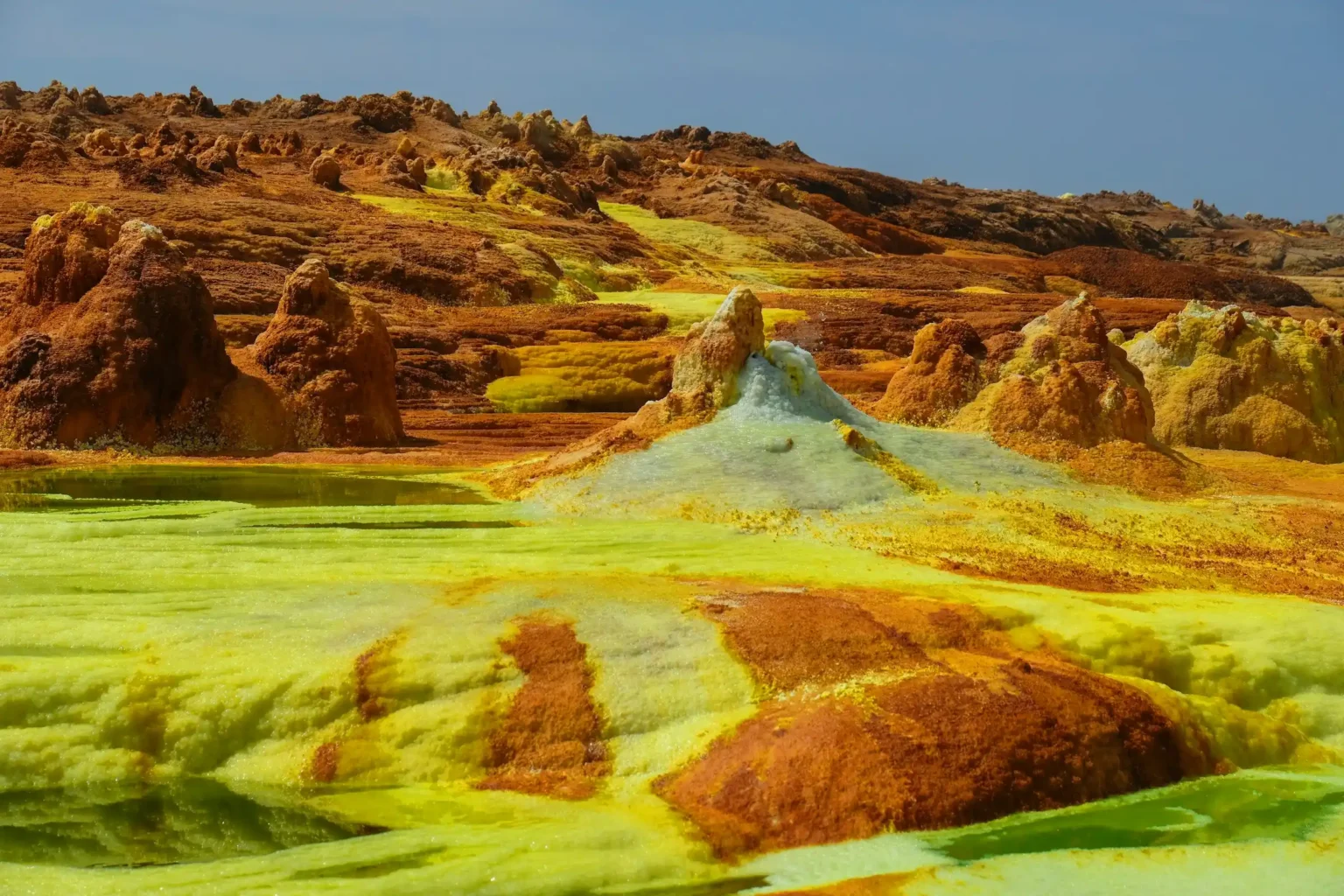
The terrain and appeal. One of the hottest and lowest places on Earth, in the Afar region. Erta Ale holds a rare permanent lava lake; Dallol is a field of acid springs in yellow, green and orange; salt caravans of camels still cross the flats as they have for centuries.
Why it remains untouched. The heat is genuinely dangerous, regularly above 45°C in the hot months, and parts of the region sit near an unstable stretch of the Eritrea border. Ethiopian regulations forbid independent travel here entirely.
Field logistics and access.
- Route: tours stage from Mekele or Semera, then run on rough 4×4 tracks to Erta Ale and Dallol.
- Permits and escort: a licensed operator is mandatory and arranges the regional permits (issued in Semera or Mekele) plus armed Afar scouts and police, without which you are turned back at checkpoints. Confirm your operator holds current papers.
- Season: November to February, when the heat is merely severe rather than lethal. Check your government’s current advice on the Afar region before booking.
- Lodging: open-air camp beds on the volcano rim and in the desert; three-day group trips commonly run USD 350–600.
4. Tuvalu, South Pacific
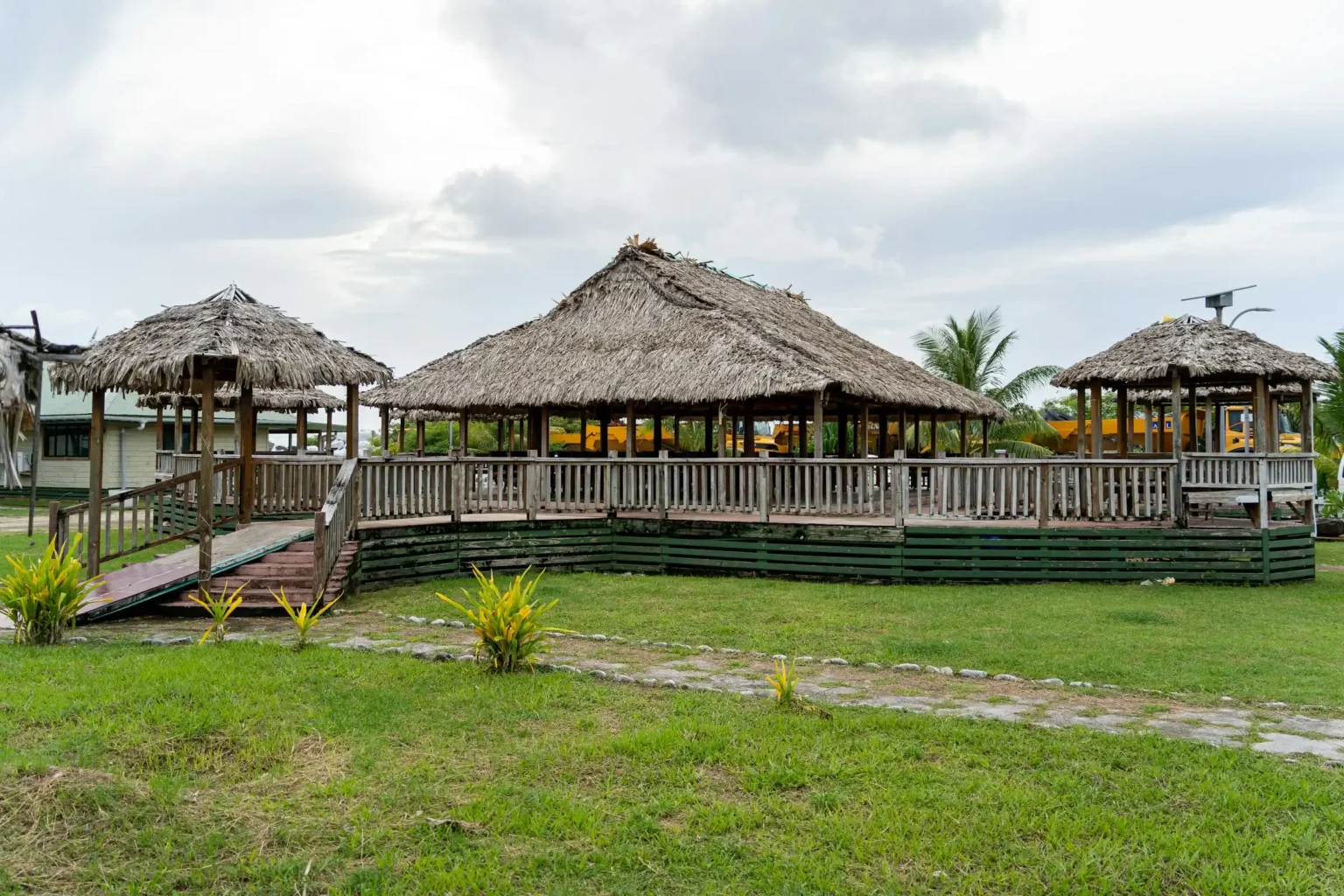
The terrain and appeal. A nation of nine low-lying atolls and reef islands and one of the least-visited countries on Earth. The draw is the absence of everything: no resorts, no tour buses, a single runway that doubles as the town’s evening football pitch, and Polynesian island life carrying on largely unbothered by outsiders.
Why it remains untouched. It is tiny, remote, and served by exactly one commercial air route. There is almost no tourism infrastructure to attract package travel, and its low elevation puts it on the front line of sea-level rise, which lends any visit a certain urgency.
Field logistics and access.
- Route: the only flights to Funafuti are operated by Fiji Airways from Suva, Fiji, a few times a week (often Tuesday and Thursday). You first reach Fiji’s main hub at Nadi, then connect to Suva.
- Permits: most Western nationals receive a 30-day visitor permit on arrival; carry a passport valid six months.
- Season: the drier May-to-October window is the most comfortable.
- Lodging: a couple of simple guesthouses and government lodges on Funafuti; book direct and in advance, and bring cash.
5. Tsingy de Bemaraha, Madagascar
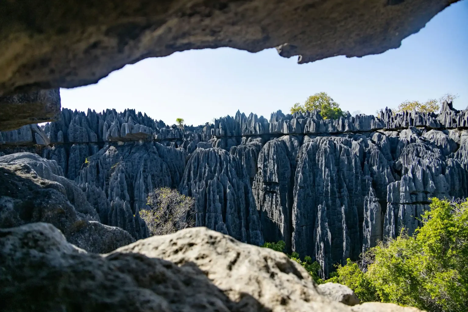
The terrain and appeal. A UNESCO-listed forest of limestone blades, some tens of metres tall, sharp enough to shred a boot, crossed on fixed cables and rope bridges. Lemurs live in the shaded canyons between the pinnacles, and the Manambolo River cuts a gorge you descend by pirogue.
Why it remains untouched. The approach is brutal. The only road in floods and turns to mud for half the year, and the park closes; even in the dry season it is a long day of driving and river crossings that filters out anyone not committed.
Field logistics and access.
- Route: fly to Morondava, then take a 4×4 for 7–10 hours to Bekopaka, the park gateway, including two river-ferry crossings (the Tsiribihina and the Manambolo). Hire a driver who knows the ferries and mud.
- Permits: a park entrance fee (around USD 15) and a mandatory local guide (roughly USD 15–20 per day); you cannot enter without a guide.
- Season: the park opens only in the dry season, April to November, and the Grand Tsingy circuit runs roughly June to early November.
- Lodging: simple lodges and camps at Bekopaka; plan at least two nights to do both the Petit and Grand Tsingy plus the river.
6. Gangkhar Puensum Base, Bhutan
The terrain and appeal. At about 7,570 m, Gangkhar Puensum is the highest mountain on Earth that has never been climbed, and it never will be legally: Bhutan bans mountaineering on its high peaks out of respect for the spirits believed to inhabit them. The reward is standing below a genuinely unconquered summit in empty northern Bhutan.
Why it remains untouched. The climbing ban removes the expedition traffic that turns other giants into base-camp cities, and Bhutan’s whole tourism model is built to keep numbers low. The base sits deep in a restricted high-altitude zone reached only on a long trek.
Field logistics and access.
- Route: enter Bhutan through Paro, then trek in from the Bumthang region; approaches to the peak area are multi-day, remote and demanding, and views are the goal, as the summit is off-limits.
- Permits: all visitors must book through a Tourism Council of Bhutan-licensed operator with a guide, and pay the Sustainable Development Fee of USD 100 per person per night (confirmed at that rate into 2027); restricted-zone trekking permits are arranged by the operator.
- Season: the Himalayan trekking windows of April–May and October–November.
- Lodging: tented camps on the trek; expect altitude, and build in acclimatisation days.
7. The Lost Coast, California, USA
The terrain and appeal. The stretch of Northern California so rugged that engineers routed Highway 1 inland rather than build along it, leaving roughly 25 miles of trail-only coast in the King Range. Black-sand beaches, elephant seals, and a shoreline you walk between the surf and the cliffs.
Why it remains untouched. There is no coastal road, sections are passable only at low tide, and a permit system caps overnight numbers. It is wild enough that the managing agency runs no rescue team, which concentrates the mind.
Field logistics and access.
- Route: the classic line runs one way, ~25 miles from the Mattole trailhead near Petrolia to Black Sands Beach at Shelter Cove, usually over three days. Arrange a shuttle, as the two ends are far apart by road.
- Permits: an overnight King Range Wilderness permit via Recreation.gov (rolling 90-day window, released daily at 7:00 am PST), plus a required hard-sided bear canister, since there are no trees to hang food.
- Tides: several miles are impassable at high tide. Carry a tide table and plan each day’s walking around the low-tide windows; do not enter the surf.
- Season: May to September is driest; pack out all waste and assume self-extraction.
8. Svaneti Valley (Ushguli), Georgia
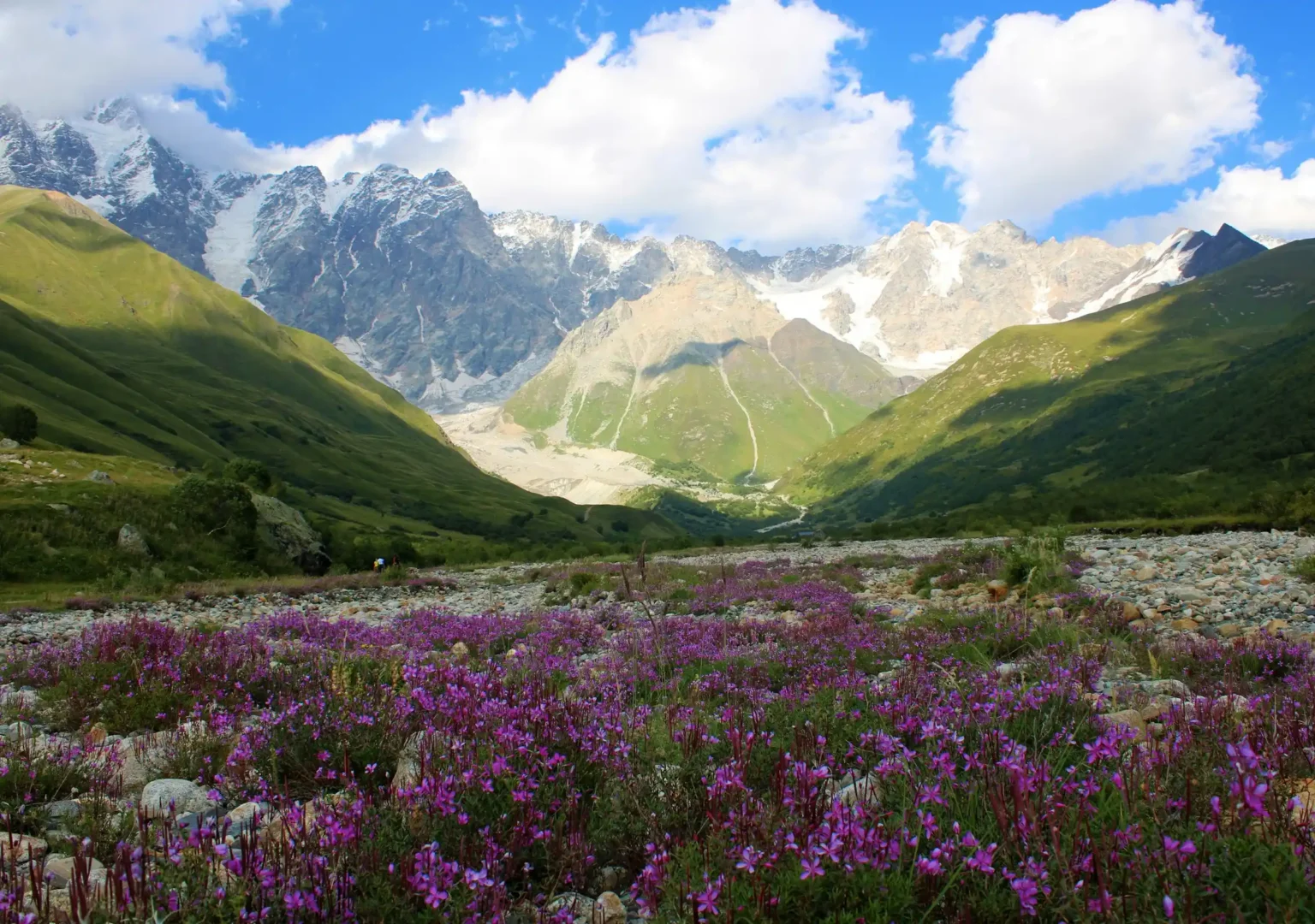
The terrain and appeal. A cluster of four hamlets at about 2,200 m in the Caucasus, among the highest continuously inhabited places in Europe, guarded by medieval Svan stone defence towers under the wall of Mount Shkhara. It is a working mountain community, not a museum.
Why it remains untouched. The final approach is an unpaved mountain road that snow closes for roughly eight months of the year, so Ushguli is genuinely cut off from mid-November into spring, and even in summer the road filters out coach tourism.
Field logistics and access.
- Route: reach Zugdidi from Tbilisi by train, take a marshrutka (minibus) on to Mestia (3–4 hours), then hire a 4×4 for the 45 km to Ushguli (3–4 hours, roughly 150–200 GEL per vehicle each way) over an unpaved road with stream crossings.
- Alternative: walk in on the four-day Mestia-to-Ushguli trek.
- Permits: none required; this is open country, but the road, not paperwork, is the barrier.
- Season: June to September for reliable road access and trekking; winter access is for the experienced and well-equipped only.
- Lodging: family-run guesthouses in the villages, most offering home-cooked half board.
9. Con Dao Archipelago, Vietnam
The terrain and appeal. Sixteen islands about 180 km off southern Vietnam, wrapped in a marine national park. Empty beaches and coral reefs sit alongside a heavy history: these were French and later South Vietnamese prison islands, and the preserved jails give the place a sombre weight most beach destinations lack.
Why it remains untouched. Distance from the mainland and protected-area status have kept development in check, and the archipelago is the country’s most important sea-turtle nesting ground, which brings real conservation controls rather than free-for-all beach tourism.
Field logistics and access.
- Route: fly to Con Dao (VCS) from Ho Chi Minh City in about 45 minutes, or from Hanoi and Da Nang; alternatively take the 4–5 hour fast ferry from Vung Tau, which you reach by road from Ho Chi Minh City.
- Permits: to watch turtles nest you join an overnight tour run by Con Dao National Park to Bay Canh Island, on a permit and in limited numbers.
- Season: turtle nesting runs roughly April to September, with hatchlings and calmer seas making September to November a strong window.
- Lodging: small hotels and guesthouses on the main island, Con Son; the outer islands are day or overnight trips by boat.
10. Salar de Uyuni’s Backcountry (Eduardo Avaroa Reserve), Bolivia
The terrain and appeal. Beyond the famous salt flat, the Eduardo Avaroa Andean Fauna Reserve is a high-altitude desert of coloured lakes: the blood-red Laguna Colorada full of flamingos, the mineral-green Laguna Verde under a volcano, steaming geyser fields, and wind-carved rock in the Siloli Desert, most of it above 4,000 m.
Why it remains untouched. The altitude is punishing, the distances are enormous, there are no towns and no paved roads inside the reserve, and the only practical way through is a multi-day 4×4 expedition sleeping in basic refuges. That combination keeps it firmly in adventure-travel territory.
Field logistics and access.
- Route: reach the town of Uyuni first, by a short flight from La Paz, an overnight bus, or the train, then join a three-day 4×4 tour that crosses the salt flat and continues south through the reserve, often ending at the Chilean border for San Pedro de Atacama.
- Permits: a reserve entrance fee (around 150 bolivianos) is collected at the gate; carry bolivianos in cash, as there are no ATMs en route. Read our full Salar de Uyuni guide before you book.
- Season: the dry season, May to October, gives the most reliable roads for the southern circuit.
- Lodging: shared refuges and salt lodges with little heating; nights fall well below freezing, so pack a serious sleeping layer, and take altitude seriously.
Logistical blueprint: planning zero-infrastructure trips
In these regions the trip is the logistics. A few systems separate a smooth expedition from a bad one:
- Satellite communication. Where there is no mobile signal and no rescue on call, a two-way satellite messenger such as a Garmin inReach or a Zoleo lets you send location updates and trigger an SOS. Carry spare batteries or a power bank, and share your itinerary with someone at home.
- Offline navigation. Download offline topographic maps before you lose signal. Gaia GPS and the offline layers in AllTrails let you follow a track and see terrain without data; do not rely on a single device.
- Medical evacuation cover. Standard travel insurance rarely covers a helicopter off a volcano or out of the Arctic. Buy a policy that explicitly includes remote-area medical evacuation, and check the altitude and activity limits. Our guide to whether travel insurance is worth it is a useful starting point.
- Waste and water. Assume you pack in and pack out everything, including human waste where required. Carry a means to treat water, and enough food to be self-sufficient, since resupply is often impossible.
- Documents and cash. Keep permits, passport copies and operator contacts both printed and offline, and carry local cash, as cards fail the moment you leave the main town. Sort out your kit early with our packing list generator.
Conclusion
The places that stay quiet stay quiet for reasons, and those reasons are logistical, not lyrical. If you are willing to book through a licensed operator, time a trip to a tide table or a dry season, carry your own safety net, and accept that no one is coming to rescue you quickly, a genuinely untouched corner of the world is still within reach. Go with the barriers, not against them, tread lightly enough that the place survives the visit, and you will see the version of travel the crowded lists have forgotten.
Frequently asked questions
What is considered the most untouched place on Earth?
Antarctica’s interior is the most untouched, with no permanent population and access only by expedition. Among places you can realistically visit, contenders include East Greenland around Ittoqqortoormiit, Yemen’s Socotra, and the Eduardo Avaroa Reserve in Bolivia, all gated by extreme isolation.
Is it legal to travel to completely uninhabited or isolated destinations?
Usually yes, but often only with conditions. Many remote regions require a government or protected-area permit, a licensed local operator, or an armed escort, and some sit behind travel advisories. Check both the entry rules and your own government’s advice before committing.
How can travelers visit remote areas without contributing to overtourism?
Book through local operators and stay in community-run lodging so money stays on the ground, travel outside peak windows, keep group sizes small, never geotag fragile sites, and follow strict leave-no-trace practice. Choosing places with real access barriers naturally spreads visitors thin.
What safety gear is mandatory for expedition travel?
At minimum: a satellite messenger with SOS, such as a Garmin inReach or Zoleo; offline maps on more than one device; a first-aid kit; water treatment; weather-appropriate layers; and, where specified, items like a hard-sided bear canister. Confirm any permit-required gear before you set off.