Bolivia Travel Guide
Plan smarter. Travel better. Discover Bolivia with tips on attractions, food, culture, budgets, and itineraries — everything you need for 2026.
Why Visit Bolivia?
Bolivia is one of South America’s most underrated destinations. In 2026, it remains one of the most affordable countries on the continent — a three-course meal in La Paz costs under $5 and a three-day Salar de Uyuni tour starts at around $150 including accommodation and meals.
From the mirror-like surface of the world’s largest salt flat to the shores of the highest navigable lake and the dense Amazon rainforest, Bolivia rewards travellers who prefer raw landscapes over polished resorts. The country covers 1,083,300 square kilometres and holds some of the most extreme geography on Earth.
Over 60% of the population identifies as indigenous, according to the World Bank. Traditions from the Aymara and Quechua peoples shape daily life, food, and festivals across the country. The annual Carnaval de Oruro, a UNESCO-recognised event, is one of South America’s largest folk festivals.
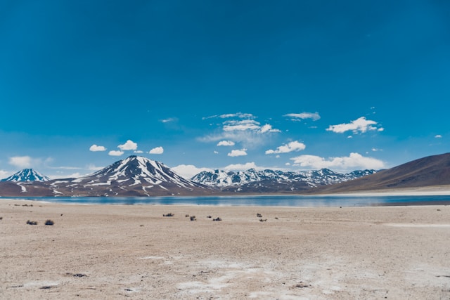
Top Attractions in Bolivia
Salar de Uyuni
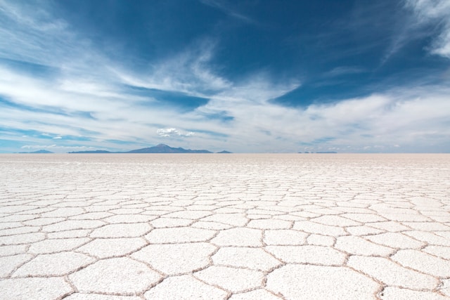
The world’s largest salt flat spans roughly 10,582 square kilometres in southwestern Bolivia. The salt crust is up to 10 metres deep in places and sits on one of the world’s largest lithium deposits. During the dry season (May to November), the surface is a vast white hexagonal crust that turns blinding in midday sun. During the wet season (December to April), a thin layer of water transforms it into a near-perfect mirror reflecting the sky.
Most visitors join a three-day tour from the town of Uyuni that covers coloured lagoons (Laguna Colorada, Laguna Verde), high-altitude geysers at Sol de Mañana, and flamingo colonies in the Eduardo Avaroa Andean Fauna National Reserve.
Lake Titicaca
At 3,812 metres, Lake Titicaca is the highest navigable lake in the world and covers 8,372 square kilometres shared between Bolivia and Peru. The Bolivian side is significantly less developed than Peru’s. Copacabana is the main base — a small lakeside town with a famous 16th-century basilica. Boat trips run to Isla del Sol, a large island believed in Inca mythology to be the birthplace of the sun. The island has no cars, two villages, and walking trails with Inca ruins.
Isla de la Luna, smaller and less visited, is half an hour further and nearly always empty.
La Paz
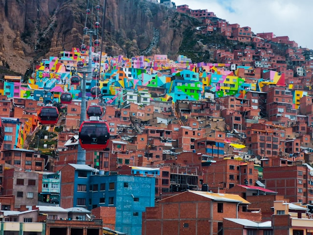
Built into a natural canyon at 3,640 metres, La Paz has a skyline unlike any other city. The densely packed streets rise from the canyon floor in tiers up to the high-altitude satellite city of El Alto at 4,150 metres. The Mi Teleférico cable car network — 10 colour-coded lines — is public transport as much as it is spectacle, crossing the canyon with views over the whole city for less than $0.50 per ride.
Key areas: the Mercado de las Brujas (Witches’ Market) on Calle Linares for Aymara remedies and tourist goods; the Prado boulevard for cafes and banks; the Sopocachi neighbourhood for restaurants; and the Valle de la Luna (Moon Valley), a 10km drive south, where erosion has carved the clay and sandstone into towers and spires.
Tiwanaku
Roughly 70 km west of La Paz on the Altiplano, Tiwanaku was the capital of an empire that dominated the Andean region between approximately 300 and 1000 AD — centuries before the Inca. The site is a UNESCO World Heritage Site and covers around 4 square kilometres, though excavations are ongoing.
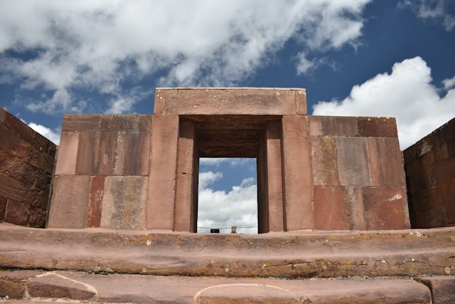
The most recognisable structure is the Puerta del Sol (Gate of the Sun) — a single monolithic arch carved from andesite, weighing around 10 tonnes. The Akapana pyramid, originally 18 metres high, and the Kalasasaya temple platform are the other main structures. The on-site museum holds the Bennett Monolith, a 7.3-metre carved stone figure, and smaller artefacts including ceramics and gold work. Half a day from La Paz is sufficient; a guided visit adds considerable context.
Sucre
Bolivia’s constitutional capital sits at 2,750 metres — lower and warmer than La Paz — and is the country’s most walkable city. The historic centre is a UNESCO World Heritage Site, lined with whitewashed colonial buildings under strict preservation rules. The city has a strong culinary reputation — it is considered Bolivia’s best destination for food after Cochabamba — and produces most of the country’s quality chocolate, particularly from cacao grown in the nearby Beni region.
Key visits: the Casa de la Libertad (where independence was declared in 1825), the Museo de Arte Indígena (ASUR) for Jalq’a and Tarabuco textiles, the Recoleta viewpoint, and Cal Orcko — a 1.5 km limestone slab outside the city bearing over 5,000 dinosaur footprints, one of the most concentrated fossil track sites in the world.
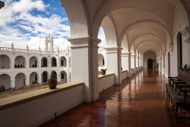
Madidi National Park
Covering roughly 18,957 square kilometres in the upper Amazon basin, Madidi is one of the most biodiverse places on Earth — home to an estimated 11% of the world’s bird species, over 200 mammal species, and more tree species per hectare than most forests on the planet. It spans elevations from glacial peaks at 6,000 metres down to 180-metre lowland rainforest.
Rurrenabaque (Rurre) is the gateway, reached by 45-minute flight from La Paz (road takes 18+ hours and is frequently blocked). Two types of tour are available: jungle (dense forest, birds, insects, plant life) and pampas (open grassland, caimans, capybaras, pink river dolphins, anacondas). Most operators run 3-day packages for both.
The Yungas Road
The North Yungas Road descends 3,500 metres over 64 kilometres from the Altiplano into the subtropical cloud forest. Before a bypass opened in 2006, it was the main supply route to the Yungas region and claimed an estimated 200–300 lives per year. Now used almost exclusively by cyclists, it runs from La Cumbre pass (4,650 m) down to Coroico (1,200 m), almost entirely on gravel with sheer drops. Tours run daily from La Paz — full downhill with support vehicle, taking around 4–5 hours to reach the bottom.
Carnaval de Oruro
Held each February in the mining city of Oruro, this is Bolivia’s most important annual event. Around 20,000 dancers and 10,000 musicians parade for nearly 20 hours through the city streets in costumes that can cost thousands of dollars to make. The central figure is the Diablada — an elaborate devil dance originating in Aymara pre-Columbian ritual, later syncretised with Catholic imagery. The whole event is recognised by UNESCO as Intangible Cultural Heritage of Humanity. Accommodation in Oruro fills months in advance; book early or stay in La Paz (1.5 hours away by bus) and day-trip.
Best Places to See — Region by Region
The Altiplano
The high plateau above 3,500 metres holds La Paz, Salar de Uyuni, Lake Titicaca, Oruro, and Potosí. Stark, largely treeless, and visually relentless. Allow at least two days at altitude before doing anything strenuous. Potosí — once the most populous city in the Americas because of its silver mines — sits at 4,090 metres and is worth a day trip for the Cerro Rico mine tours and the Casa de la Moneda (royal mint museum).
The Valleys
Sucre (2,750 m) and Cochabamba (2,550 m) are warmer, greener, and at lower altitudes than the Altiplano — a genuine relief if you have struggled with acclimatisation. Cochabamba is considered Bolivia’s culinary capital; the city’s market food scene, particularly around La Cancha, is exceptional. The Valle de Cochabamba is known for its temperate climate and fruit production.
The Amazon Basin
Northern and eastern lowlands centred on Trinidad and Rurrenabaque. Madidi National Park and the Pampas wetlands (Yacuma) are the main draws. This is the Bolivia of caimans, pink river dolphins, howler monkeys, macaws, and anacondas. The heat and humidity are intense — average temperatures of 30–35°C, high year-round humidity. The wet season (Nov–Apr) makes road access nearly impossible but increases wildlife visibility on the pampas.
The Chaco
Bolivia’s southeast corner — hot, flat, and almost entirely undeveloped for tourism. Kaa-Iya del Gran Chaco is one of South America’s largest protected dry forests at 3.4 million hectares. Appeals almost exclusively to serious birdwatchers (over 400 species) and travellers specifically seeking the extreme off-grid experience. Road travel here requires self-sufficiency.
Best Time to Visit Bolivia
| Season | Months | Weather | Best For |
|---|---|---|---|
| Dry season | May – Oct | Clear skies, cold nights on Altiplano (−5°C or below), dry roads | Uyuni solid crust, Yungas Road, trekking, overland travel |
| Shoulder | Nov – Dec | Occasional afternoon rain, warming temperatures | Fewer tourists, lower accommodation prices, Uyuni filling with water |
| Wet season | Jan – Apr | Daily rain in lowlands, some roads close | Uyuni mirror effect (Jan–Mar), Carnaval de Oruro (Feb), Madidi wildlife |
June–July are peak months with higher prices and more crowds at Uyuni and Titicaca. September–October offer the best balance of dry weather and fewer tourists. The Amazon lowlands are worth visiting in the dry season (May–Oct) when roads are open — the wet season (Nov–Apr) makes some pampas areas accessible only by boat.
Getting to Bolivia
Bolivia has two main international airports. El Alto International (LPB) serves La Paz at 4,061 metres — the world’s highest commercial airport. Arriving here means stepping straight into high altitude with no acclimatisation, which affects some travellers severely. Viru Viru International (VVI) serves Santa Cruz at 416 metres — far easier on the body and worth considering as an entry point if your itinerary allows it.
There are no direct long-haul flights to Bolivia from Europe, North America, or Asia. Connections run through Lima (most common, shortest layover), Bogotá, São Paulo, Buenos Aires, or Santiago. BoA (Boliviana de Aviación) and LATAM are the main carriers on Andean routes.
Overland entry points:
- From Peru via Copacabana — the most-used tourist crossing, from Puno across Lake Titicaca. Straightforward, busy, well-served by bus operators.
- From Chile via Tambo Quemado — high-altitude crossing at 4,600 m on the road from Arica to La Paz. Dramatic, cold, not advisable without prior acclimatisation.
- From Argentina via Villazón/La Quiaca — southern crossing into Potosí and Sucre direction. Train service runs from Buenos Aires to the border at La Quiaca.
- From Brazil via Puerto Quijarro — eastern lowland crossing near Santa Cruz. Long train journey from Corumbá (Brazil) possible.
Getting Around Bolivia
Long-distance buses are the backbone of travel between Bolivian cities. The overnight routes (La Paz–Sucre, La Paz–Potosí, La Paz–Copacabana, Cochabamba–Santa Cruz) are well-served by comfortable semi-cama (reclining seats) and full-cama (flat beds) coaches. Journey times are long — La Paz to Sucre is 10–12 hours — but fares are cheap, typically $8–20 for cama class.
Domestic flights connect La Paz, Santa Cruz, Sucre, Cochabamba, Tarija, Trinidad, and Uyuni. BoA and Ecojet are the main operators. Fares from $60–120 one-way, often cheaper booked in advance through the airline’s own website. The La Paz–Rurrenabaque flight (45 min vs. 18 hrs by road) is almost always worth the extra cost.
Mi Teleférico in La Paz has 10 colour-coded cable car lines that function as the city’s urban transit system between La Paz (canyon floor) and El Alto (plateau). Single rides cost Bs3–5 (under $0.50). Far faster than road travel between the two cities and genuinely spectacular.
Shared taxis (taxis trufi) run fixed urban routes and are the standard way to get around inside Bolivian cities for Bs2–5 per trip.
Why Does Bolivia Have Two Capitals?
Sucre is the constitutional capital and seat of the judiciary. La Paz is the administrative capital where the president and congress operate. This split dates back to the Federal Revolution of 1899, when tin-mining elites in La Paz and the north used their economic dominance to shift the executive government there. Sucre kept the Supreme Court and its constitutional status as a compromise. Both cities claim capital status and neither designation has changed since.
Both cities are worth visiting — La Paz for energy, altitude, and urban intensity; Sucre for colonial architecture, walkability, and warmer weather. Domestic flights connect them in 45 minutes; the bus takes 10–12 hours.
Altitude and Health
Acute Mountain Sickness (AMS) affects a significant proportion of travellers arriving in La Paz (3,640 m) or El Alto (4,061 m), particularly those flying in from sea level. Symptoms include headache, nausea, fatigue, dizziness, and disrupted sleep. Most cases are mild and resolve within 24–48 hours with rest, hydration, and coca tea.
Practical steps:
- Avoid alcohol and strenuous activity for the first 48 hours
- Drink 3–4 litres of water per day
- Eat light meals — altitude slows digestion
- Coca tea (mate de coca) is widely available and genuinely helps with mild symptoms
- Acetazolamide (Diamox, 125–250 mg twice daily) is the most effective pharmaceutical option — start 24 hours before arrival, consult a doctor beforehand
- If symptoms worsen (severe headache, vomiting, confusion, difficulty breathing at rest) — descend immediately. Do not sleep at altitude with worsening symptoms
Santa Cruz at 416 m offers no altitude challenges and is a useful acclimatisation base before heading upland.
Water: tap water is unsafe to drink anywhere in Bolivia. Buy bottled water or use a filter. Food from established market stalls is generally safe — raw salads from street vendors carry higher risk.
Vaccinations: no vaccinations are legally required, but yellow fever is recommended for travel to the Amazon lowlands. Hepatitis A, typhoid, and routine vaccines are sensible precautions. The CDC Bolivia travel health page has current recommendations.
Costs and Money
The Bolivian boliviano (BOB) trades at approximately 6.9–7 per US dollar as of 2026. The official exchange rate and black market rate differ — use official exchange houses (casas de cambio) or bank ATMs. US dollars and Argentine pesos are widely accepted in tourist areas and border towns; euros less so outside La Paz and Santa Cruz.
ATMs: available in all cities but often limited in smaller towns. Machines regularly impose per-withdrawal limits of BOB 1,000–1,500 (~$145–215). Carry cash for travel outside cities. Visa is more widely accepted than Mastercard at ATMs.
| Category | Budget | Mid-range | Comfortable |
|---|---|---|---|
| Accommodation (per night) | $8 – 18 | $25 – 60 | $70 – 160 |
| Meals | $1.50 – 5 | $5 – 15 | $15 – 35 |
| Uyuni 3-day tour | $120 – 160 | $180 – 250 | $300+ |
| La Paz–Rurre flight | ~$80 – 120 one-way | ||
| Daily total estimate | $25 – 40 | $60 – 110 | $120 – 200 |
Essential Travel Tips
Altitude: La Paz sits at 3,640 m. Drink coca tea, stay hydrated, and avoid alcohol for the first 48 hours. See the full altitude and health section above.
Currency: The Bolivian boliviano (BOB). ATMs work in cities but carry cash for rural areas. US dollars widely accepted.
Language: Spanish is primary. Bolivia recognises 37 official languages including Quechua and Aymara. English is spoken in tourist-facing businesses in La Paz and Sucre but is rare elsewhere.
Transport: Long-distance buses are the main mode. Domestic flights connect La Paz, Sucre, Cochabamba, Santa Cruz, and Rurrenabaque.
Safety: Generally safe for tourists. Use only radio taxis (called in advance) or official taxi apps in La Paz — tourist robberies in unmarked taxis do occur. Watch for bloqueos (road blockades by protesters, common in Bolivia) before long journeys. Check local news the day before travelling overland.
Photography: Always ask before photographing indigenous people in traditional dress — many communities in the Altiplano object and some charge a fee. Military installations and border infrastructure must not be photographed.
Frequently Asked Questions
What are the top attractions in Bolivia?
The Salar de Uyuni, Lake Titicaca, and La Paz are the three most popular. A two-week itinerary comfortably adds Sucre, Tiwanaku, and a 3-day Amazon tour from Rurrenabaque.
Is Bolivia expensive to visit?
Bolivia is one of the cheapest countries in South America. Budget accommodation starts at $8–15/night, market meals cost $1.50–5, and a three-day Uyuni tour runs $120–160. A comfortable daily budget of $60–90 covers good accommodation, restaurant meals, and transport.
Do I need a visa for Bolivia?
It depends on your nationality. Most South American and many European citizens enter visa-free. US citizens need a visa ($160, available on arrival or in advance). Always verify current requirements before travel — Bolivia’s visa policy has changed more than once in recent years.
How do I handle altitude sickness?
Acclimatise for at least 48 hours before strenuous activity. Drink 3–4 litres of water daily, eat lightly, avoid alcohol, and drink coca tea. Acetazolamide (Diamox) taken 24 hours before arrival significantly reduces symptoms for most people — consult your doctor. If symptoms worsen rather than improve, descend.
Can I visit Salar de Uyuni year-round?
Yes. The dry season (May–Oct) gives the iconic white salt crust with hexagonal patterns. The wet season (Dec–Apr, peaking Jan–Mar) creates the mirror effect when 10–20 cm of water covers the flat. Tours run year-round; operators adjust routes for conditions. The mirror effect season is increasingly popular and accommodation in Uyuni fills fast.
What language is spoken in Bolivia?
Spanish is the main language in tourist areas. Bolivia recognises 37 official languages — Quechua and Aymara are most widely spoken after Spanish. In indigenous communities on the Altiplano, Aymara may be the only language spoken by older residents.
Is it safe to travel overland in Bolivia?
Generally yes, with caveats. Road quality varies from good paved highways (La Paz–Oruro–Uyuni) to rough unpaved tracks (Yungas, Chaco). Road blockades (bloqueos) by protesters can close routes for days with no advance notice. Check local travel forums and news before any long overland journey. Night buses on the main routes are safe and widely used.
Plan Your Bolivia Trip
Use these free tools to prepare every detail before you go.