Bolivia Beaches: Lakes, Rivers, and Water Destinations
No ocean, but Lake Titicaca, Amazon rivers, altiplano lagoons, and thermal springs more than make up for it. A 2026 guide.
arrow_back Back to Bolivia GuideBolivia Beaches: What You Need to Know First
Bolivia is landlocked and has no ocean coastline. It lost its Pacific coast to Chile in the War of the Pacific (1879–1883). But Bolivia’s freshwater alternatives are genuine destinations — not consolation prizes.
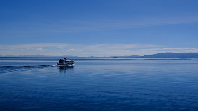
Lake Titicaca alone covers 8,372 square kilometres, stretches 190km long, and reaches depths of 281 metres — standing on its shore feels like the edge of an inland sea. The Amazon rivers near Rurrenabaque offer warm-water swimming in a jungle setting. The altiplano in the southwest holds some of the most visually striking lagoons on the continent. And the Uyuni circuit passes natural hot springs you can soak in at sunrise with snow-capped volcanoes in the background.
The key variable is temperature. Lake Titicaca sits at 3,812 metres with water around 10–14°C year-round — cold enough to make swimming a brief event. Lowland rivers reach 24–28°C. Crater lakes and thermal springs land somewhere in between.
Lake Titicaca: Bolivia’s Best Beach Alternative
The Bolivian side of Lake Titicaca is far less touristed than Peru’s Puno side, with fewer crowds and lower prices. The lake is slightly brackish (salinity 5.2–5.5 parts per thousand), not pure freshwater, which is a surprise to most visitors.
Copacabana
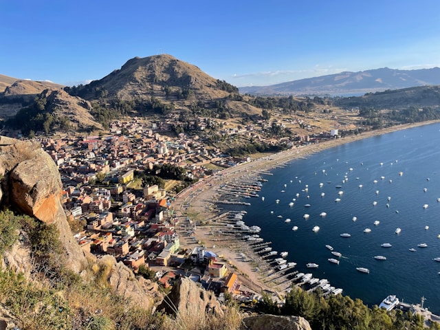
The main Bolivian gateway to Lake Titicaca, sitting at 3,841 metres on a sheltered bay with a narrow sandy beach that curves for around 600 metres. Locals swim and sunbathe here from October to March — the water stays cold, but it’s the warmest period. Pedalos, paddle boards, and small motorboats are available for hire directly on the beach.
The waterfront Avenida 6 de Agosto runs alongside the beach and is lined with restaurants serving freshly grilled trucha (lake trout). The town’s dominant landmark, the 17th-century Basilica of Our Lady of Copacabana, is a short walk uphill from the waterfront. Cerro Calvario, the hill directly behind town, is a 45-minute climb with crosses and offerings at the top and broad views over the bay.
Getting there: 3.5–4 hours by bus from La Paz’s Cementerio bus terminal, around 30 BOB ($4.50). The route crosses the Strait of Tiquina — passengers disembark and cross on small motorboats while the bus is loaded onto a wooden barge separately. It’s a 15-minute crossing and a reliable part of every Copacabana trip.
What to do: Walk the beach, hire a pedalo, boat to Isla del Sol, eat trucha lakeside, climb Cerro Calvario for sunset views.
Isla del Sol
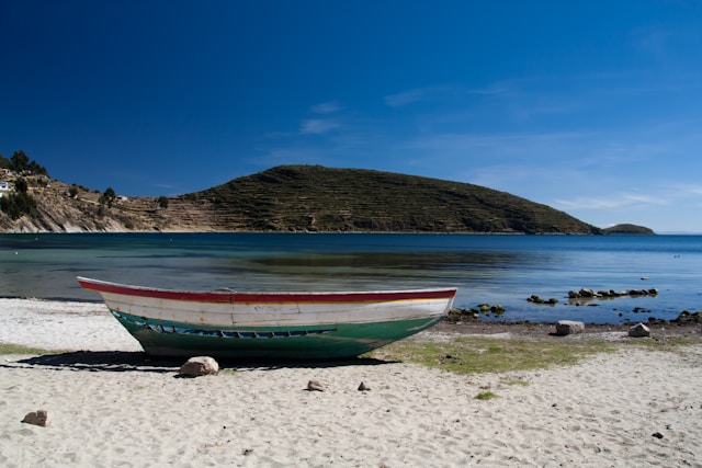
A terraced island 9.6km long and 6.4km wide, reachable by boat from Copacabana’s main pier. No cars, no paved roads. The two main villages are Challapampa in the north and Yumani in the south — boats typically go to one or both.
Challapampa in the north has the most accessible beach area, a rocky-sandy stretch where you can wade into the lake. The site museum here displays artefacts recovered from underwater excavations conducted between 1989 and 1992. The Chinkana ruins — a labyrinthine Inca structure — are a short walk from the north landing. Titi Qala, the Sacred Rock, sits nearby: Inca legend holds that the sun itself was born here, making Manco Cápac the first Inca.
At Yumani in the south, the Inca Staircase descends 206 steps to a natural spring — one of the most photographed features on the island. The north-to-south hiking trail covering the full length of the island is approximately 11km and takes 3–4 hours at altitude. Boats to the north depart Copacabana from around 7:30am; the last return is typically around 4–4:30pm.
What to do: Hike north-to-south trail, visit Sacred Rock and Chinkana, wade in the lake at Challapampa, stay overnight in Yumani for sunrise over the lake.
Isla de la Luna
Smaller and less visited than Isla del Sol. It holds ruins of an Inca temple dedicated to the moon goddess (Mama Quilla). Boat tours often combine both islands in a day trip from Copacabana. The quiet here is noticeably different from the more tourist-trafficked north — a handful of families, a few basic guesthouses, terraced hillsides dropping to the lake.
Altiplano Lagoons: No Swimming, but Unforgettable
The southwest altiplano, toured as part of the 3-day Uyuni salt flat circuit, holds a chain of high-altitude lagoons that are among the most visually striking water destinations in South America. These are not swim spots — the altitude, cold, and in some cases toxic mineral content rule that out — but they belong in any Bolivia water guide.
Laguna Colorada
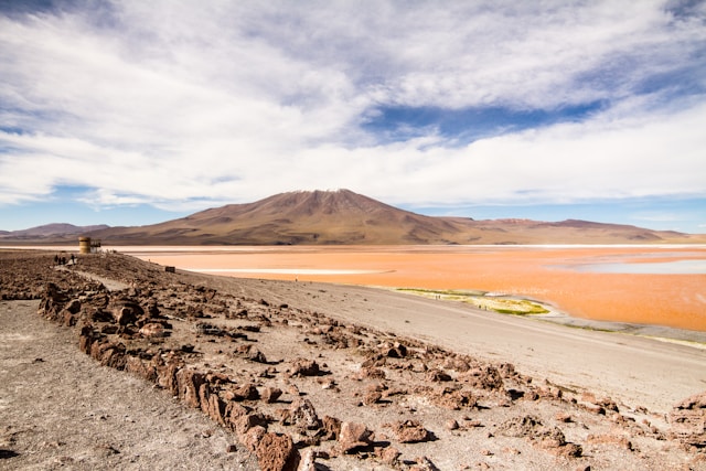
At 4,278 metres, inside the Eduardo Avaroa Andean Fauna National Reserve, Laguna Colorada covers approximately 60 square kilometres but is only 1.5 metres deep at its maximum. The water is crimson-red from a combination of red sediments and the pigmented algae Dunaliella salina, which thrives in the saline conditions. White borax islands break the surface in the shallows.
Three flamingo species feed here — James’s flamingos (the most abundant), Andean flamingos, and Chilean flamingos. The abundance of plankton sustains large flocks year-round. Laguna Colorada received Ramsar wetland designation in 1990.
Laguna Verde and Laguna Blanca
Near the Chilean border at the base of Licancabur volcano, Laguna Verde gets its intense turquoise colour from high concentrations of arsenic, magnesium, calcium, and lead suspended in the water. The colour shifts from pale mint to deep jade depending on wind conditions — calm mornings produce the most vivid colour. Laguna Blanca sits immediately adjacent, separated by a narrow strip, its white sediment providing a stark contrast.
Both are typically visited at the end of the Uyuni circuit on the final morning, alongside the Dali Desert and the Salvador Dalí-esque rock formations.
Thermal Springs
Bolivia has several accessible natural hot springs — actual warm-water soaking experiences in extraordinary settings.
Aguas Termales de Polques
A small natural hot spring at around 4,300 metres altitude, located near Laguna Colorada on the Uyuni circuit. The water temperature is roughly 30°C — warm enough to soak in, with steam rising against the cold morning air. Most Uyuni tour operators stop here at sunrise on the final day. The pool itself is a simple stone structure, minimal facilities, but the setting — volcanic altiplano, silence, flamingos on the lagoon nearby — is hard to match. Bring a swimsuit.
Urmiri Hot Springs
Located about 150km south of La Paz in Oruro Department, Urmiri is one of the more accessible thermal spring destinations from the capital. Mineral-rich water, a more developed bathing facility than Polques, and a day trip option for those based in La Paz.
Amazon and Lowland Water Destinations
Rurrenabaque and the Pampas
The gateway to Bolivia’s Amazon sits on the east bank of the Beni River, 410km from La Paz by road (18 hours by bus) or 45 minutes by plane. River tours through the Pampas wetlands run on flat-bottomed boats through open savannah channels — this is Bolivia’s best wildlife encounter, with pink river dolphins, black caimans, capybaras, anacondas, and hundreds of bird species. Swimming in the warm river is included in some Pampas tours; guides select safe sections and keep watch. Water temperature reaches 24–28°C.
Best time: May to October (dry season), when wildlife concentrates around shrinking water sources and riverbanks are accessible. The town floods during rainy season (November–March).
Getting there: TAM Bolivia and Amaszonas operate flights from La Paz (El Alto Airport) to Rurrenabaque, around $150–200 return. Budget 3–4 days minimum for a Pampas tour.
Coroico River (Yungas Region)
White-water rafting and tubing through subtropical valleys where the Andes drop sharply into cloud forest. Rapids range from Class II to IV. The Yungas region sits below the Altiplano plateau — temperatures here are dramatically warmer than La Paz. Several operators in Coroico offer half-day and full-day trips. Water is clear and cold from snowmelt, warming to around 18–22°C lower in the valley.

Laguna Volcán and Lowland Lakes
Near Santa Cruz, Laguna Volcán sits in the crater of an extinct volcano in Florida Province, close to Amboró National Park. The lake measures 436 metres long by 190 metres wide — a compact oval of warm water surrounded by forest. Vehicular access runs through an opening in the crater wall; a footpath circles the lake. The warm water and shaded setting make it a popular weekend retreat for Santa Cruz residents.
Water Destinations Comparison
| Destination | Type | Best Time | Swim? | Water Temp |
|---|---|---|---|---|
| Copacabana | High-altitude lake | Oct – Mar | Yes (cold) | 10–14°C |
| Isla del Sol | Lake island | May – Oct | Wading/brief | 10–14°C |
| Rurrenabaque Pampas | Amazon river | May – Oct | Yes (guided) | 24–28°C |
| Coroico River | Mountain river | May – Nov | Rafting/tubing | 18–22°C |
| Laguna Volcán | Crater lake | Year-round | Yes | Warm (22–26°C) |
| Laguna Colorada | Altiplano lagoon | Year-round | No | Near freezing |
| Aguas Termales de Polques | Hot spring | Year-round | Yes | ~30°C |
The Sea That Bolivia Lost
Bolivia’s landlocked status is the result of a 19th-century war, not ancient geography.
Before 1879, Bolivia had a Pacific coastal strip centred around the port of Antofagasta — today a city in northern Chile. The War of the Pacific (1879–1883) erupted over a mining tax dispute between Bolivia and Chilean companies operating in Bolivian territory. Chile occupied Antofagasta early in the conflict. Peru entered the war as Bolivia’s ally under a secret mutual defence treaty. Chile won decisively on both fronts.
The 1904 Treaty of Peace formalised Bolivia’s loss — roughly 400 kilometres of coastline and 120,000 square kilometres of territory containing valuable nitrate and copper deposits. In exchange, Chile agreed to build a railway connecting Bolivia to the Pacific port of Arica, which remains in use today.
Bolivia observes Día del Mar (Day of the Sea) every March 23, with ceremonies and school events marking the loss. The country maintains a naval force — the Bolivian Navy — stationed on Lake Titicaca and Amazonian rivers despite having no ocean access. In 2013, Bolivia filed a case at the International Court of Justice seeking negotiations over sovereign ocean access; the ICJ ruled in 2018 that Chile was not obligated to negotiate, but the issue remains central to national identity.
Tips for Visiting Bolivia’s Lakes and Rivers
Acclimatise before swimming at altitude. At 3,812 metres, even light swimming at Lake Titicaca feels exhausting. Spend at least two days in La Paz or Copacabana before water activities. Cold-water shock at altitude is a real risk — enter gradually.
UV at altitude is extreme. The UV index at Lake Titicaca and on the altiplano regularly reaches 12–14 (extreme range). Wear SPF 50+, a hat, and cover your shoulders, even on overcast days. The combination of altitude and water reflection amplifies exposure.
Book Rurrenabaque tours locally. Agencies in Rurrenabaque offer Pampas tours at significantly lower prices than La Paz operators. A 3-day Pampas tour costs around $100–150 USD booked locally.
Bring a swimsuit for the Uyuni circuit. Aguas Termales de Polques is a genuine hot spring stop, but most travellers arrive unprepared. It’s a highlight of the circuit — pack one.
Swim in Amazon rivers only with guided tours. Guides know which sections are safe and watch for caimans and other wildlife. Never enter Amazon rivers independently.
Frequently Asked Questions
Why doesn’t Bolivia have a sea?
Bolivia lost its entire Pacific coastline to Chile in the War of the Pacific (1879–1883). The 1904 treaty formalised the loss. Bolivia commemorates this annually on Día del Mar (March 23) and maintains a navy to this day on Lake Titicaca and Amazonian rivers.
Can you swim at Lake Titicaca?
Yes, but the water is cold — typically 10 to 14°C year-round. Most visitors wade or take a brief dip. The best spots are the sheltered beach at Copacabana and the coves near Challapampa on Isla del Sol. October to March is the warmest period.
Does Bolivia have any beaches at all?
No ocean beaches. Copacabana has a genuine sandy lakeshore on Lake Titicaca. Lowland crater lakes near Santa Cruz (like Laguna Volcán) have warm sandy shores. Amazon river sections have sandy riverbanks. None are ocean beaches, but several are proper swim destinations.
What water activities can you do in Bolivia?
Kayaking and boat trips on Lake Titicaca, river tours and wildlife swimming near Rurrenabaque, white-water rafting on the Coroico River, soaking in the Aguas Termales de Polques hot springs on the Uyuni circuit, and boat tours through the Pampas wetlands.
Is it safe to swim in Bolivia’s rivers?
Safe when part of a guided tour. Guides select safe sections and monitor for caimans and other wildlife in the Amazon. At Lake Titicaca, the main risk is cold-water shock — enter gradually and stay near shore if unacclimatised. The Coroico River’s higher rapids require experience or a guided rafting operator.
What is Laguna Colorada?
A shallow (1.5m deep) crimson-red lagoon at 4,278 metres in the Eduardo Avaroa National Reserve, southwest Bolivia. The red colour comes from pigmented algae (Dunaliella salina) and red sediments. Three flamingo species feed here year-round. It’s visited as part of the 3-day Uyuni salt flat circuit and is not a swimming destination.